Old Watford
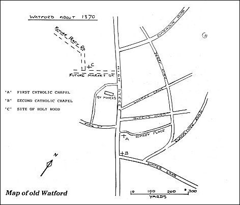
At the beginning of the nineteenth century Watford consisted of a single long road, now known as Lower High Street, with a number of adjoining alleys and yards. It extended from the open market near the parish church of St. Mary to the ford at the river Colne, from which it got its name. The population in 1801 was 3,530, including the nearby hamlets of Oxhey, Leavesden and Cashio.
Watford from early times was the centre of an agricultural district and its market, which was granted a charter from Henry I some 900 years ago, attracted farmers and others from far and wide. Agriculture and the market occupied many Watford residents, but industry included several wool and silk mills with their associated cottages for the workers, line quality handmade paper and straw plaiting and, of course, brewing for which Watford became well known.
Over the years the population of Watford showed little increase, but the coming of the railway in 1837 soon changed it from a small rural town to a fast growing industrial and dormitory area. By 1851 the population had increased to 5,000 and by 1881 to 10,000. The opposition of the Earls of Essex and Clarendon to the railway being routed through Cassiobury and Grove Parks meant that the line had to be diverted around them, and tremendous construction work on the necessary cutting and tunnel north of Watford undertaken. Local reluctance to the presence of the railway in Watford itself resulted in the station being built first over the St. Albans Road Bridge north of the present site and subsequently in 1858 where it is now.
However it was not long before people began to discover that the railway was not only a great convenience for the quicker transport of produce, but that it made it possible to work in London and yet live in the pleasant rural countryside, thus commuting became popular that long ago. This led to the development in 1864 of Queens Road and Clarendon Road to give more direct access to the Junction Station. Other roads leading off them then followed.
